As an official in Colombia’s Ombudsman’s Office, I was a member of an interdisciplinary team that documented the issues faced by artisanal fishermen. I soon became aware of a serious widespread problem which receives minimal public attention. Those who engage in fishing activities in lentic inland waters, such as lakes, ponds and “ciénagas”, often share a common concern: the waters on which they depend have not been properly demarcated.
In other words, the delineation process, known locally as “deslinde,” has not been completed to define the boundaries between ecosystems belonging to The Colombian State and those areas where private property rights apply. This is not a recent issue, on the contrary, this represents a long-standing information gap. The State does not have clear data in regards to delimited wetlands and academia has not extensively explored the problems associated with this process.
The consequences of this lack of information are severe. Some of the most well-known include the appropriation of amphibious shores (floodplain lakes referred to in Colombia as “playones”), the loss of fauna and flora due to changes in land use, an increase in property concentration, and the abandonment of collective practices in flood-prone areas. This situation particularly affects the ciénagas, which are wetlands that play a crucial role in mitigating rising water levels during periods of heavy precipitation. They also help to regulate river flows and support the reproductive cycles of fish.
Furthermore, there has not been a participatory process to delimit the ciénagas, where the limits of the wetlands are decided with the support of the local population. It is essential to recognize that rural communities are an integral part of these ecosystems, but the Colombian State fails to acknowledge the interdependence that exists between wetland ecosystems and artisanal fishermen. These fishermen, in many cases, have lived in harmony with the surrounding biodiversity for generations.
Artisanal fishermen are advocating for the demarcation of the ciénagas – the natural environment which feeds them, provides them protection from flooding in the rainy seasons and whose amphibious shores are where they cultivate seasonal crops.
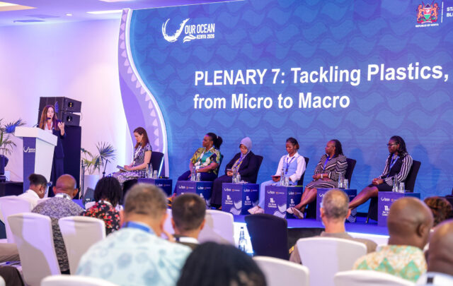
The full Interdialogue with Juan Manuel Quinche.
In November 2021, as a member of the Ombudsman’s Office, I visited various fishing towns in the southern part of northern Colombia’s Bolívar department. This included Magangué, which is one of the municipalities with the largest expanse of wetlands in the country, as it sits within the alluvial plain where the Cauca, Magdalena and San Jorge rivers converge.
During this visit, I had the opportunity to witness Ernesto Cifuentes, one of the leaders in the region, appeal to the Ombudsman for more dedicated support in the delineation of flood-prone lands:
“The fishing leaders are afraid to call for the demarcation of the beaches because, as has occurred in other municipalities and departments of Colombia, fishing leaders are targeted and attacked. However, today, our organization dares to call for the demarcation!,” Ernesto declared before being cheered on by fellow fishermen. (Editor’s note: Ernesto’s name has been changed for security reasons).
The Colombian State often does not consider the fishermen when developing public policy towards wetlands. On the contrary, The State overlooks the fact that ciénagas are socio-ecological systems (SES), where nature does not exist in isolation from human influence. In truth, ciénagas co-evolve with local communities, fostering two-way interactions that significantly impact the well-being of both.
The delineation of wetlands is a way of acknowledging their presence. If public institutions were to proceed with the implementation of this demarcation, they would make a significant contribution to the conservation of these socio-ecological systems. This process would document their existence, their natural boundaries and the interconnections that need to be preserved or restored to sustain life.
Those “responsible” for delineating the ciénagas
The public institution in Colombia responsible for delimiting wetlands is known as the National Land Agency (ANT), which also functions as the agrarian authority responsible for recovering ecosystems when individuals seek to exploit them as if they were private property.
To delineate a ciénaga, the ANT must collaborate with the Regional Autonomous Corporations (CAR). Since 2011, the CARs have been responsible for determining the maximum flood levels and conservation areas of wetlands, information that is crucial in identifying boundaries of a ciénaga. There have been profound issues of coordination within and between the two institutions.
It is the fishermen who have to deal with the consequences of this disconnect. When they file complaints, official communications are exchanged between the mayor’s offices (the primary local law enforcement authority) and the agricultural and environmental authorities, and this rarely results in any tangible changes on the ground.
This is a recurring scenario in the Colombian Caribbean Region, comprising seven departments with jurisdiction over many of the country’s major rivers that flow into the Atlantic Ocean. Given its geographic location and the prevalence of low-lying and inundated areas, this region boasts the second-largest number of wetlands in the country, surpassed only by the Orinoquía region in eastern Colombia, which is home to 15,614 wetlands.
The case of Ciénaga Grande del Bajo Sinú
Located in the lower course of the Sinú River (a basin that originates in the northwest of Colombia in the mountain range known as “Nudo de Paramillo”), the Ciénaga Grande del Bajo Sinú (“the great ciénaga of the lower Sinú River”) hosts a continental water system made up of 17 ciénagas, which together cover nearly 44,000 hectares of floodplain. In much of this region, there are widespread issues of land appropriation.
Five years ago, the communities bordering this ciénaga complex appealed to the local government to resolve land ownership conflicts in the Ciénaga de Corralito, one of its wetlands. At the end of 2018, a group of mayors sought clarification from the agrarian authority regarding whether this ciénaga was allocated for public use. The then Deputy Director of Agrarian Processes simply indicated that “to determine this, it will be essential for the competent environmental authority in the jurisdiction to technically verify the land’s characteristics and report whether it does indeed correspond to a ciénaga.”
This is a verification process that typically draws out over time. While communities await a definitive response from the responsible authorities, as is often the case with many wetlands across the Caribbean region, major landowners use this delay to expand “their” farms by altering the boundaries of the ciénagas. This tactic is evident in maps of the Ciénaga Grande del Bajo Sinú, as private properties tend to increase in size as they approach the main reflecting pool of the ciénaga.

“Predial” evaluation map of the Ciénaga Grande del Bajo Sinú Integrated Management District, elaborated by the Regional Autonomous Corporation of the Sinú and San Jorge River Valley and the National University of Colombia – Medellín Campus in 2007
Property conflicts surrounding ciénagas pose significant challenges. Unlike terrestrial ecosystems, flooded areas give rise to questions that are challenging to resolve concerning their existence or extent. Collective local memory and technical-scientific knowledge can converge to bridge this information gap. For example, technical analyses can be complemented by incorporating first-hand local knowledge.
Explore the full Interdialogue with Paulo Murillo.
Inadequate participation and a lack of qualified people within these government institutions continue to be persistent problems. While collecting information for my master’s thesis, I had a conversation in July 2022 with the Deputy Director of Planning at a CAR in the Caribbean Region. She mentioned that they had acquired and updated the software to determine the maximum water level of the wetlands under her jurisdiction. However, they only had two professionals who had the required technical knowledge to complete this task. Her statement affirmed an observation I had made during my time as an official from the Ombudsman’s Office, where I noticed that even when there was willingness, cases piled up due to the absence of qualified personnel.
Despite the administrative challenges, fishermen continue their commitment to environmental protection with a perseverance that, on occasions, has prompted the State to complete some delimitation processes. This should not be the exception; delineation should be the standard practice in various regions where it could serve as a foundation for wetland-focused planning.
The challenge: Understanding demarcation as part of a broader process
The campesinos (a large Colombian peasant demographic “vitaly involved in working directly with land and nature, with forms of social organization based on family and community work,” as defined by the Colombian Institute of Anthropology and History) and fishermen of the Ciénaga Grande del Bajo Sinú have previously achieved key historic demands. Protests that began in the later part of the 20th century pushed the agrarian authority to delimit its ciénaga system in 1982 and to regulate the agrarian demarcation process in 1990.
The Colombian State ended up undervaluing these documents, and when the agrarian authority was restructured in 2003, many of its documents became compromised. The importance of the demarcation documents grew with “the possibility of reconstructing the truth about the titling and dispossession processes,” as noted by the Constitutional Court in 2012, who implemented measures to protect its archive. The proceedings related to the Ciénaga Grande del Bajo Sinú were one instance in which part of the archive files were lost, and its reconstruction is ongoing.
While working at the Ombudsman’s Office, I observed that this lack of information hinders the renewal of “rights of use” for fishermen in flood-prone areas. Demarcation is key to guaranteeing access, as required by current regulations when conflicts arise over land ownership, something that is a common occurrence in most of the ciénagas.
The full Interdialogue with Juan Manuel Quinche.
A state administrative act alone is insufficient for demarcation; it is essential to ensure a participatory process that respects local knowledge and fosters dialogue centered on ecological principles. While technical tools can assist in establishing wetland boundaries, they must not overshadow or disregard local knowledge.
This recurring narrative persists in the region: local communities are often overlooked in favor of projects devised in the capital (Bogota), resulting in negative impacts to these socio-ecological systems.
In 1993, for example, the ‘Urra Multipurpose Project’ was authorized along the Sinú River, and a hydroelectric plant was built without the approval of Indigenous communities. Along the lower course of the river, communities soon witnessed the degradation of wetlands due to the lack of water and sediments.
Contrary to the Indigenous Zenú People, who had previously applied adaptive hydraulic technologies for ciénaga management across the river’s entire span before colonization, the Colombian State did not perceive the river as a unified system from its source to its mouth. In the 1990s, the State failed to understand the river’s dynamics and continued fragmenting it. This led to the desiccation of wetlands, by negatively impacting sediment capture, flow regimes and fish migration.
Some in the region still do not understand that balance in the ciénagas is determined by factors transcending physical boundaries, which leads to interventions that cause nonlinear impacts within these dynamic interconnected basins.
Certain campesino associations do in fact take these dynamics into consideration. In 2013, for example, APROPAPUR implemented ridges, water reservoirs and an area of protection in part of the Ciénaga Grande del Bajo Sinú, to secure their food sovereignty, replicating the Zenú hydraulic structure.
“The ecosystem had lost its dynamism and no longer fulfilled its functions as it should. This compelled us to fight for its preservation because it was the only viable option,” says Juan Manuel Coneo, APROPAPUR’s president. “This practice is often referred to as ‘amphibious,’ allowing us to adapt to the changing environment,” he emphasized to me.

Terrace system used by APROPAPUR to replicate the hydraulic system of the Zenú Indigenous People. Multimedia file used with permission from the APROPAPUR organization.
Ironically, the agrarian institution has at times hindered these practices through its “irregular policy of declaring public lands located on the outskirts of the Córdoba ciénagas as vacant,” as noted by the Constitutional Court in 1999 when they decided to protect the rights of fishermen affected by the Urrá Hydroelectric Plant. Given these circumstances, it is crucial for the State to implement demarcation processes in order to recognize both the boundaries of the ciénagas and their traditional inhabitants.
While the legal prohibition of appropriating wetlands is essential, it is also important to challenge colonial-era preconceptions that negatively depicted “ciénagas” centuries ago, when the term was coined. Ciénaga stems from the root ‘cieno’ (sludge) derived from the latin caenum, meaning “filth.”
Actions based on linear thinking that disrupt the vital ecological connectivity of bodies of water, such as ciénagas, must be scrutinized to ensure that such measures will in fact benefit local populations.
Alternatives proposed by Non-Governmental Organizations for wetland restoration
Some non-governmental organizations (NGOs) spearheaded wetland restoration processes in Colombia through international cooperation and funding, focusing on projects that aim to enhance the livelihoods of artisanal fishermen and biodiversity. At times, they collaborate closely with environmental authorities and promote local participation in activities such as restoring hydrological cycles and monitoring.
Such collaboration occurred when APROPAPUR adopted the Zenú adaptation project in partnership with the Caribbean Environmental Heritage Foundation. The NGO facilitated intercultural dialogue between the interdisciplinary team – led by anthropologist Carlos Castaño – the campesinos, and Indigenous communities.
“They made us co-authors in a sense because it was a process that unfolded in the field,” recounted Juan Manuel Coneo. “When they initiated measurements, Carlos invited the Zenú community to participate in the construction… It was like a dialogue of sharing and active participation.”

Adaptation of a campesino territory to replicate the hydraulic system of the Zenú Indigenous People. Multimedia archive used with permission from the APROPAPUR organization.
A similar case emerges in the collaboration between the Alma Foundation and The Nature Conservancy (TNC) – Colombia. With funding from the United States Agency for International Development (USAID), they have been working on riparian forest restoration near the Zapatosa Ciénaga Complex since 2013, an area situated between the departments of Magdalena and Cesar.
Beyond involving campesinos in the process of establishing community nurseries for forest restoration, they have endeavored to negotiate sustainable practices with big cattle ranchers, incentivizing the adoption of silvopastoral systems and discouraging the intrusion of buffalo or bovine cattle onto the marshes’ shores (although in reality this isn’t always met with interest by the large landholders).
According to leaders of these NGOs, undertaking wetland restoration becomes more viable when they have environmental protection measures, such as in the case of Zapatosa, which has had Ramsar status since 2021. This ensures international attention and more active participation from public institutions.
Explore the full Interdialogue with Ernesto Mancera.
In fact, some organizations endorse the establishment of new “Integrated Management Districts,” which outline permissible activities in specific wetland areas and develop “management plans” in collaboration with the local communities.
“What we did was start with workshops and participatory methodologies, conducting vulnerability assessments to climate change,” says Juanita González, leader of Nature-Based Solutions for Adaptation at TNC-Colombia. “With this information, we outlined the actions and adaptation measures we would implement.”
Organizations such as TNC-Colombia routinely bridge knowledge gaps and address institutional capacity challenges within environmental authorities. At times they play a pivotal role in defining the permanent and dynamic water levels, as well as doing hydrological modeling and geospatial analyses.
Despite their diligent efforts, NGOs cannot complete an official demarcation process, as this is an exclusive responsibility of the agrarian authority. To finalize an agricultural demarcation procedure, essential stages such as property studies, visual assessments and notifications to potential landowners must be conducted, all of which fall under the purview of the competent authority. However, the contribution of NGOs remains highly relevant, even if they cannot execute all of these stages.
At times, various environmental protection measures may overlap, necessitating reconciliation. The Natura Foundation has successfully achieved this in the Ciénaga de Barbacoas and the Zapatosa Ciénaga Complex through the ‘GEF Magdalena-Cauca Vive Project.’ Their approach aims to harmonize plans from different protection frameworks in order to facilitate ecological restoration. They take the entire ecosystem into account and actively involve local communities.
This approach departs from previous government practices, such as relocating communities in and around wetlands, which fails to address habitat rehabilitation. For organizations like the Natura Foundation, ecological restoration entails restoring water connectivity and riparian forests. Given limited resources, the participation of the public sector is vital to sustain these efforts.
“We have stepped in to fill the void left by an entity that was not performing these tasks. Now we are trying to say, ‘Look, city hall, here’s the solution…take it up,’” Mery Cecilia Torres, Fisheries Manager of the GEF Magdalena Cauca Vive Project, recently emphasized to me.
The work of NGOs contributes to a national demarcation policy that the Colombian State should enact. The public sector can incorporate lessons from NGOs that recognize wetlands as interconnected socio-ecological systems, and advocate for their demarcation. Campesino communities continue to eagerly await this progress.
Towards understanding wetlands as interconnected socio-ecological systems
Throughout its life as a republic, Colombia has made significant strides in its understanding of wetlands. In 1974, these areas were officially recognized as a type of surface water, with their shores designated as State property and not subject to alienation. However, this legal framework is often disregarded by large landowners and still lacks comprehensive understanding across different sectors of society.
Ecological knowledge can play a crucial role in bridging this gap. The state’s responsibility goes beyond merely delineating boundaries between private property and common areas within wetlands; it should also involve planning that takes into account internal wetland dynamics and conceptual frameworks.
If wetlands were to be understood as socio-ecological systems that evolve in tandem with human communities, the process of demarcation would encompass these systems. Such a definition would include an understanding of wetland dynamics, including issues of private property, within the broader context of social and natural interactions.
It would emphasize the interconnectedness of wetlands with the environment and human groups, recognizing their respective interests and how they respond to the challenges posed by the climate crisis. Additionally, it would acknowledge the valuable contributions of wetlands to ecological restoration and traditional knowledge.
While NGOs provide valuable technical and human support in this endeavor, the presence of the Colombian State remains indispensable.
Specifically, attention should be directed towards the Executive Branch, the central government entity responsible for finalizing long-overdue demarcations and strengthening delineation authorities. Improving the process, which currently lacks meaningful community participation, is of utmost importance.
We look forward to potential changes from the current government, bearing in mind that the current President of the Republic, Gustavo Petro, during his tenure as a senator, co-authored bill number 136/20 with fellow congressmen. This bill aimed to engage communities in the “delimitation, formulation and participatory implementation of recovery, restoration, replacement and conservation plans, along with environmental education.”
While the central government’s role in wetland policy is crucial, the Judicial Branch is also indispensable, particularly the jurisprudence of the Constitutional Court. Previously, the Court issued orders to halt ciénaga allocations and questioned individual interventions in wetlands under the pretext of ‘conservation’ of their properties. Their contributions must continue.
The full Interdialogue with Juan Manuel Quinche.
In August 2022, Judge Natalia Ángel Cabo began reviewing a tutela (an appeal for immediate relief that allows citizens make claims to their fundamental rights) case brought by COMENALPAC, the largest artisanal fishing organization in Colombia. This organization seeks to protect the rights of fishermen in the Cascaloa Ciénaga Complex, which have been violated due to the construction of a road in the municipality of Magangué. This road disrupted the vital ecological and hydrological connectivity of the wetlands.
On May 9, 2024, the Constitutional Court of Colombia issued the Ruling T-623 of 2024, through which the fundamental rights to environmental participation, a healthy environment, a dignified life and the work of the artisanal fishermen of Cascaloa Ciénaga, were protected. This is a juridic event that transcends the local life of the municipality of Magangué, as this ruling addresses a common scenario for the entire Caribbean region and wetlands of Colombia.
Thanks to this ruling, fishermen can now resort to a tutela action to seek immediate protection when infrastructure is built that disconnects two bodies of water and causes negative ecological and social impacts.
Now comes the important and complex fulfillment of this precedent-setting judgment. Specifically, beyond the document a monitoring mechanism must be set up that transcends the words of the ruling and materializes into real actions of ecological restoration and sustainable coexistence. Fortunately, there is the constant presence of consolidated social organizations such as COMENALPAC, and the committed support of NGOs such as the Tiempos de Vida Coalition, who have begun to make visible the importance of this historic judicial action.
This ruling has the potential to redefine part of the Colombian State’s approach to inland bodies of water, its understanding of ciénagas as socio-ecological systems, and to establishing safeguards for those who rely on wetlands for their lives and livelihoods.
Funding Information: This research received funding in 2022 through the Doctoral Training Support Program (PAFD), sponsored by the German Academic Exchange Service (DAAD) and the Federal Ministry of Cooperation. This support was established under a specific agreement between the Development Research Center (ZEF) at the University of Bonn in Germany and the Institute of Environmental Studies (IDEA) at the National University of Colombia.