
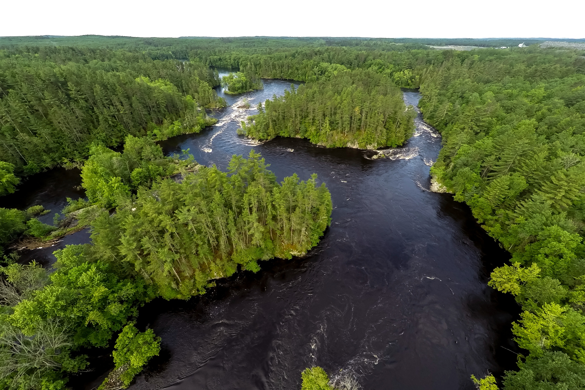
Celebrated today for its extensive forests and pristine streams, Marinette County, Wisconsin, has been in recovery for over a century. Its story is one of dramatic change, demonstrating that given time and stewardship—with respect for limits—the land can mend, nourishing its people.
As glaciers retreated from the region some 12,000 years ago, the barren landscape of the upper Midwest began a successional transition. Climax forests were composed of old-growth pine, hemlock, oak, and maple.
The Menominee, the Indigenous people that have inhabited the region for 10,000 years, relied on these forests for sustenance and shelter. Their namesake, the Menominee River, lies on the eastern border of the county. According to the Menominee’s origin story, passed on through oral tradition, their people were created at the mouth of the river where it enters Green Bay in Lake Michigan.
The region’s Indigenous population flourished through fishing, hunting, farming, and harvesting wild rice (manoomin). Viewing the natural world as kin, not just resources, they lived in a steady state.
Paradise Lost, Then Partially Found
Europeans altered the natural balance of the Northwoods. Soon after they arrived, they trapped and traded fur, exploited fish populations, and clearcut forests, displacing the Menominee and their ways of life. The Menominee’s territory was reduced from roughly 10 million acres to a reservation of 235,000 acres. Today, the reservation practically comprises Menominee County, which neighbors Marinette County.
By the early 1900s, Wisconsin’s majestic forests were gone. And as industrial development followed the initial wave of reckless logging, Marinette County faced a new threat of toxic pollution.

But over the past few decades, the county has developed a sense of stewardship that has led to the restoration of much of its former beauty. It is now home to the second-largest county forest in Wisconsin. Sustainable timber harvesting is now the standard. Pollution has been largely curtailed, and the land and water have staged a comeback.
Marinette County could well become a model of sustainability. However, sprawling development may impede its progress as the next iteration of economic threat to ecosystems. As in many counties, this type of development is spreading along and out from the county highways and byways. Meanwhile, neighboring Menominee County remains unaffected by such sprawl. Local leaders in Marinette County stand to learn from the Indigenous practices and worldviews that have enabled Menominee not only to curb development, but also to set new benchmarks in wetland restoration and forestry.
Origins
Marinette County’s population of permanent residents has plateaued since 2000, landing on approximately 42,000 people in 2020. One quarter of the population lives in the City of Marinette, which serves as the county seat. The city is near where the Indigenous village of Menekaunee once stood, at the mouth of the Menominee River.

The city and county were named for Marie Antoinette Chevalier, a prominent, mixed-heritage French and Menominee leader known locally as “Queen Marinette.” Only a handful of U.S. counties are named to honor Indigenous women, attesting to Queen Marinette’s influence among both Indigenous and European inhabitants of the region. She established an important trading post and facilitated critical understandings between her tribe, white settlers, and government.
Despite Queen Marinette’s influence, the federal government pressured the Menominee to cede their homeland through various treaties. Eventually, in 1854, the tribe secured a permanent reservation in Menominee County, some 15 miles west of Marinette County. Soon, settlers began clear-cutting the deep forest, using the Menominee River as transport for their massive logging operations. Over the course of the lumber-industry boom, companies floated 10 billion feet of logs down the Menominee, scouring the riverbed and covering spawning beds with silt. This severely degraded fish habitat, leading to a decline in fish stocks.
The ravaged landscape, left exposed with dead brush and debris, was primed for wildfire. Adding to the risk, a severe drought in the summer of 1871 left the land parched. On October 8th of that year, strong winds and high temperatures coincided, and an unprecedented firestorm ensued. The source of the conflagration is unknown, with speculation ranging from untended land-clearing fires to meteor debris.
The fire engulfed the southern third of Marinette County and extended into the Upper Peninsula of Michigan. It reached temperatures of over 2,000 degrees Fahrenheit and created hurricane-like winds of 110 mph. The firestorm incinerated entire communities, claiming over half the population of another Marinette County town, Peshtigo. By October 10th, the fire had reached 1.5 million acres, with an estimated death toll of over 2,500 people. The “Peshtigo Fire” remains the deadliest fire in U.S. history.
Reforestation and Industrialization
After the great fire, residents sought to establish farms on the barren land. However, their efforts were largely met with failure as agricultural prices crashed following World War I. Land abandonment due to failure to pay taxes became common.

In 1930, Marinette County registered the tax-abandoned properties as non-taxable public forest land. They established one of the first county forests, which now occupies one quarter of the county at over 230,000 acres. Further reforestation consisted of efforts by the Civilian Conservation Core (CCC) in the 1930s. After a century of concerted effort, Marinette County now boasts forest cover on over 79% of its land.
But deforestation hasn’t been the only threat to the county’s ecosystems. After the lumber boom and subsequent fire came the development of industry. Paper production, shipbuilding, and eventually chemical production became mainstays of the local economy. These activities dealt an added blow to the Menominee River with discharges of waste.
Pollution from mills located near the City of Marinette and in the nearby City of Menominee in Michigan severely impacted the region’s habitats and waterways. Tyco, a company that produces fire-retardant foam, was found to have knowingly contaminated groundwater with PFAS, or forever chemicals, and kept it a secret for years. These persistent chemicals are a major cause of advisories against eating fish from Lake Michigan.
The combination of impacts led to the lower Menominee River being listed as an Area of Concern (AOC) in 1987, as part of the international Great Lakes Water Quality Agreement. The area was identified as one of the 43 most severely degraded hotspots in the Great Lakes watershed.
The Ongoing Recovery

Just as Marinette County’s reforestation efforts have proven successful, so has its work to clean up the industrial-waste legacy of the past century. Wisconsin’s state government has used regulations to curtail the sources of pollution, and Marinette County has followed up with extensive work to recover contaminated soil and water. Part of Green Bay was dredged to remove some 30 million pounds of sediment containing industrial-paint sludge and other hazardous waste. 320,000 cubic yards of arsenic-laden deposits were recovered from the Lower Menominee.
Work to shrink the PFAS groundwater plume, including a $25 million groundwater extraction and treatment system, is ongoing. Furthermore, on June 24, 2026, Tyco agreed to pay $10 million into Wisconsin’s PFAS Trust Fund, alongside other provisions, to facilitate a clean-up. After over three decades of efforts and $150 million spent, the Menominee was officially delisted as an AOC in 2020. As a testament to the ongoing restoration, toxins such as PFAS have been declining in fish stocks in the Great Lakes.
21st-Century Stewardship
Slowly but surely, Marinette County has been healing from two centuries of destructive economic activities. The recovered forests and abundant wetlands in the northern two-thirds of the county have protected the numerous streams found there.
The Wisconsin Department of Natural Resources (WDNR) has designated over half of Marinette County’s rivers and streams as either Outstanding or Exceptional. The county holds the record for the state in streams of such high quality, providing a home for rainbow and brook trout, which are especially sensitive to environmental changes.
For many who work to protect aquatic ecosystems, Marinette County is especially significant because of a landmark 1972 case, Just v. Marinette County. This case, according to professor Rob Fischman of Indiana University’s Maurer School of Law, was one of two that set a standard in defending the Public Trust Doctrine. This doctrine is fundamental in permitting government to protect the environment as a public trust.
Pathways to a Steady State

Owing to a stable population and mildly fluctuating GDP of about $2 billion per year, Marinette County could play a leading role in “steady statesmanship” and thereby attain a sustainable, steady state economy. To preserve its biocapacity, the county aims to harvest timber at rates equal to natural regeneration rates.
One major challenge to forest regeneration in many Wisconsin counties, including Marinette, is deer over-abundance. Recent studies by the WDNR indicate that high browse pressure is “chronic or widespread” throughout the county. This hampers the growth of new trees, preventing them from replacing older trees and threatening a sustainable harvest.
Indigenous examples of forest stewardship provide a promising model. Researchers have found that tribal forests in Wisconsin have greater diversity and healthier trees than other forests, public or private. One major difference is that the Menominee government allows year-round deer hunting for sustenance in tribal forests, while there is only a nine-day hunting season in public forests state-wide; a managerial relic from the bad old days of extremely low deer densities in the Northwoods.
Likewise, wetland-stewardship practices of Wisconsin tribes can serve as models for county and state policies. In an interview for the Herald, Erin O’Brien, Policy Programs Director at Wisconsin Wetlands Association, spoke about the state of wetlands in Wisconsin. She pointed to Wisconsin’s impressive record in preventing net loss and restoring wetlands in recent years. And she highlighted tribes, such as the Oneida Nation, as leaders in wetlands restoration and planning.
Furthermore, satellite imagery reveals that low-density development that fragments forests and wetlands is rare in Menominee County, which is mostly composed of the Menominee Indian Reservation. Instead, a clustered development pattern appears dominant in Menominee.
The same cannot be said for Marinette County, where sprawl is expanding along and from many roadways. The resulting fragmentation degrades the environment, as well as the natural beauty of the landscape. But Marinette County can take steps to retain its natural integrity and beauty. For example, they can revise their zoning code. They can expand public land by integrating land forfeitures into the forest as they have done in the past. Adopting policies that maintain farm, forest, and wetland integrity are essential for a steady state.
Coming full circle—employing an ethos that existed among native peoples for thousands of years—is a pathway to a steady state, to keep the county great. Regenerative practices, reciprocal stewardship, and the view that decisions must weigh impacts far into the future should inform Marinette County’s policies.
Will Marinette County hold the line on scattered, low-density development? If so, this would solidify Marinette as a model for other counties, to Keep Our Counties Great for generations to come.