Since 2005, British Columbia’s experiment with hydraulic fracturing of gas wells has changed the geology of the province’s northeast. It is now home to some of the world’s largest fracking-induced earthquakes outside of China.
In 2018, one magnitude 4.6 tremor tied to fracking even rattled buildings in Fort St. John and stopped construction on the Site C dam. It was followed by two strong aftershocks.
Now, a comprehensive new scientific study warns that stress changes caused by the technology could trigger a magnitude 5 earthquake or greater in the region, resulting in significant damage to dams, bridges, pipelines and cities if major regulatory and policy reforms aren’t made soon.
Allan Chapman, the author of the paper, served as a senior geoscientist for the BC Oil and Gas Commission and as its first hydrologist from 2010 to 2017. Prior to working for the commission, he directed the Ministry of Environment’s River Forecast Centre, which forecast floods and droughts.
Chapman, now an independent geoscientist, told The Tyee that he felt compelled to write the paper because researchers have concluded that fracking “induced earthquakes don’t have an upper limit” in terms of magnitude.
In addition,
“there is a clear and present public safety and infrastructure risk that remains unaddressed by the regulator and the B.C. government.”
The BC Oil and Gas Commission rejected Chapman’s conclusions in a statement to The Tyee, saying his study contained “speculation.”
Recent events in China’s Sichuan province prove that fracking can trigger large and destructive earthquakes.
Gas drilling operations there generated shallow earthquakes between magnitude 5.3 to 5.7 in recent years that resulted in deaths, extensive property damage and angry protests by local citizens.
Chapman says the commission’s current system for managing tremors, known as a “traffic light protocol,” can’t prevent larger magnitude earthquakes because it ignores how cumulative fracking over time destabilizes shale formations with high pressures and increases seismic risk.
“To protect people and infrastructure, we are going to have to avoid fracking in some areas,” he told The Tyee.
Public infrastructure placed at risk by fracking now includes “the communities of Dawson Creek, Fort St. John, Taylor, Hudson’s Hope, Upper Halfway (Halfway River First Nation) and possibly others, and infrastructure such as the WAC Bennett, Peace Canyon and Site C dams, community water supply and treatment systems, the Taylor Gas Plant, the Taylor Bridge crossing of the Peace River, numerous earthen water storage dams, and others,” said the paper.
The Taylor Bridge, for example, was built in 1960 prior to the fracking boom, which has changed both seismic patterns and risks in the region.
The bridge, now deteriorating, is responsible for transporting millions of dollars of merchandise, food and fuel every hour between Fort St. John and Dawson Creek in the province’s Peace Region.
More fracking, more tremors
Given that 60 to 70 per cent of earthquakes greater than magnitude 3 are already caused by hydraulic fracturing in the giant Montney shale formation that straddles B.C.’s border with Alberta, Chapman forecasts more and larger tremors in the future.
One factor, he says, is accelerated drilling to serve Shell’s LNG Canada project in Kitimat, B.C.
Another factor he cites is that the injecting of fracking fluid deep into the ground appears to have a cumulative effect.
Chapman’s study documents how fracking-induced earthquakes “increase in both frequency and magnitude in relation to frack fluid injection volumes, and that there appears to be a cumulative development effect where prior frack fluid injection possibly resets the seismic potential in certain tectonic environments to allow for eased earthquake initiation related to future lower-volume injections.”
As a consequence, writes Chapman, “the future in the Montney is not if earthquakes greater in magnitude than 5 will occur, but when, with that occurrence possibly without any precursor warning.”
Chapman’s study, published in the Journal of Geoscience and Environmental Protection this week, also sheds a light on companies triggering the earthquakes as well as the inadequacy of current mitigation measures and legislation.
Hydraulic fracturing blasts large volumes of pressurized water, sand and chemicals deep into concrete-like shale formations one to two kilometres in the Earth.
That force shatters rock underground with a network of fractures so that methane, oil or natural gas liquids can be released.
It can also connect to natural faults triggering swarms of earthquakes.
‘Speculation’ says oil and gas commission
In a statement to The Tyee, the BC Oil and Gas Commission outright rejected Chapman’s analysis. “Our geological and engineering experts have concluded it is based on a number of unproven assumptions or incomplete consideration of the factors cited.”
The commission added that the paper didn’t look at Montney’s structural setting, fault types and local rock stress.
It added: “Speculation such as is in this paper requires expertise in seismology, fracturing, reservoir engineering, ground motion and critical infrastructure. All of the commission’s research and changes to regulatory framework are vetted through partner organizations that retain full-time, trained seismologists.”
The commission did not specifically answer questions from The Tyee on the adequacy of the traffic light protocol in the Montney.
The commission is entirely funded by industry.
Unlike most papers on fracking and earthquakes, Chapman’s study is one of the first to name companies responsible for large tremors in northeastern B.C.
The scientist said he did so for reasons of accountability. “It is in the public interest for their names to be known.”
Since 2012, 77 per cent of the earthquakes triggered by fracking in the Montney have been caused by three companies: Petronas, Tourmaline Oil and Ovintiv (formerly Encana).
Petronas, a Malaysian company, holds the record for most quakes. Its fracking activities are associated with 78 per cent of the earthquakes in the northern Montney and almost one-half the earthquakes in the entire Montney over the 2013 to 2019 period.
Researchers estimate that one out of 150 wells fracked wells in Western Canada will trigger a magnitude 3 tremor.
But Chapman found that that 1.7 per cent of fracked wells (about one out of 60 wells) in B.C. are associated with earthquakes with magnitudes of 3 and up. That’s nearly double the rate of earlier research.
The Montney shale formation, which contains both methane and liquid condensates, sits under a vast area of timber, farmland and wilderness on 26,600 square kilometres of Treaty 8 land extending from south of the community of Dawson Creek to 200 kilometres northwest of the community of Fort St. John.
Between 2012 and 2019, nearly a dozen companies have fracked 2,865 wells with 39 million cubic metres of water in the Montney.
The volume of pressurized water used per well has increased steadily in recent years from an average of 7,077 cubic metres per well in 2012 to 22,054 cubic metres per well in 2019.
Many operators including Ovintiv, Petronas and CNRL have fracked wells using more than 30,000 cubic metres per well. ConocoPhillips stands out for using 83,000 cubic metres per well for 13 wells in 2019.
Beginning in 2008, industry started to trigger “felt” earthquakes greater than magnitude 3, raising concerns throughout the region.
[slide-anything id=’3472166′]
B.C. and Alberta regulators initially denied the industry could cause earthquakes that significant and then called them “anomalous” or minimized their shaking motions to a truck driving by.
As industry injected more volumes of water into the ground to fracture gas-bearing rock, the frequency of earthquakes jumped from an average of 1.6 magnitude 3 quakes a year to almost 6.9 magnitude 3 tremors by 2019.
Petronas led with the highest earthquake rate: “39 per cent of its fracked wells are associated with earthquakes,” followed by Tourmaline Oil with 29 per cent and Ovintiv at nine per cent.
Effects of repeated injects build up: study
Cumulative injection has played a dramatic role in triggering many tremors in the Montney region, said Chapman.
In November 2018, for example, CNRL set off three tremors by injecting nearly 15,000 cubic metres of water in two hydraulically fracked wells that resulted in three quakes, including a magnitude 4.6 tremor that rattled the Site C dam and shut down construction operations for a day.
“However, this seems to be the proverbial straw that broke the camel’s back,” noted Chapman in the study.
Prior to the three headline-making tremors, four operators within a five kilometre radius of the seismic events had injected 1.72 million cubic metres of water into 109 fracked wells over a period of three years.
“As many as 29 per cent of the Montney earthquakes are associated with hydraulic fracturing conducted by multiple operators over antecedent time periods of one year and longer, in some cases as many as four operators,” noted the report.
Various studies by both U.S. and Canadian researchers have demonstrated that stresses from frack operations can migrate distances of over 10 kilometres through natural fractures in the rock and destabilize rock pressure for long periods of time, making it impossible for industry or regulators to predict when earthquakes might occur from fracking.
Research commissioned by the BC Oil and Gas Commission acknowledges that “only small fluid pressure increases are sufficient to cause specific sets of fractures and faults to become critically stressed,” in the southern Montney.
“Once you have primed an area and started the triggering of earthquakes, it doesn’t take much more injection to keep the seismicity going,” said Gail Atkinson, one of Canada’s top seismic hazard researchers.
The scientist described Chapman’s study as “excellent work” and an important contribution to the research.
Atkinson, who held an Industrial Research Chair in Induced Seismicity at Ontario’s Western University until her retirement in 2020, added that Chapman’s findings are consistent with what she’s found in her own studies on fracking and earthquakes in Western Canada’s oil and gas fields. “Some areas, once you get them going seismically are much harder to turn off than on.”
Drilling by Petronas in 2015 provides an example of the importance of cumulative impacts in Chapman’s study.
In August of that year, the company’s fracking generated a magnitude 4.6 earthquake in the north Montney. “For this event, Petronas was the sole operator, injecting 67,625 cubic metres of frack fluid into three wells in the week before the earthquake,” noted the science paper.
But over a two-year period prior to the event, Petronas had injected a total of 275,000 cubic metres of frack fluid into the ground.
‘Traffic light protocol’ won’t brake a big quake: experts
In 2015, the BC Oil and Gas Commission introduced the traffic light protocol in an attempt to control damaging earthquakes.
According to the protocol, if a company causes an earthquake of magnitude 4 or greater within three kilometres of its fracked well, it must shut down its operations — a red light event.
The protocol in the southern Montney uses magnitude 3 as its red light for stopping fracking. (In contrast, the United Kingdom set magnitude 0.5 as its red light.)
Many researchers including Atkinson have questioned the efficacy of the protocol, because many induced earthquakes don’t produce smaller “yellow light” warning events.
Fracking can also cause large earthquakes months or even years after a well has been fracked.
And local ground-shaking motions can be severe at much smaller magnitudes.
Many magnitude 3 earthquakes in B.C. have been triggered by wells nearly six kilometres from the epicentre.
“Only 26 per cent of the trigger wells are within three kilometres of the earthquake,” reported Chapman. However, some of the larger observed triggering distances may be a result of significant uncertainty in earthquake locations.
B.C.’s traffic light protocol has been inconsistently enforced and is “ineffective,” Chapman said.
Calls for ‘no-frack zones’ near key infrastructure
cCurrently, much seismic information in the oil patch is considered proprietary and may not be made public for a year after a quake.
He’s also advocating for an enhanced earth monitoring system that collects more real-time data with a much larger network of seismographs than currently exists.
“Let’s say we get a 5.5 magnitude quake and there are deaths and damages and the Peace River Bridge is underwater,” said Chapman in an interview. “And four companies are found to be fracking in the same area at the same time. Having clear and transparent information on these events will help with accountability.”
These changes need to be made now, because the completion of the Coastal GasLink pipeline and LNG Canada by 2025 will drive increased activity in the region with an additional 10,000 fracked wells.
That means injecting into underground seams 230 million cubic metres of water, enough to fill 100,000 Olympic-sized swimming pools. Which would be almost six times more frack fluid than was injected during the 2012 to 2019 period of fracking the Montney basin.
Chapman has little doubt that will destabilize parts of the Montney resulting in more or larger earthquakes. “The implications are quite profound,” he said.
The hydrologist also thinks that First Nations, community groups and engineers of bridges and dams in the region need to be engaged in transparent public discussions about the growing earthquake risks posed by fracking.
“Other agencies like ministries of highways and transportation need to be involved and engaged because bridges once thought to be risk-free are no longer risk-free with fracking.”
Atkinson supports Chapman’s call for no-frack zones near critical infrastructure, calling the idea a “no-brainer.”
Given science’s inability to predict large induced quakes,
“the best approach — the only one shown to work — is basically have a no-go zone around critical infrastructure. It is a puzzle to me why it is such a hard sell given the abundance of oil and gas resources in the region.”
Alberta researchers and Ryan Schultz at Stanford University have questioned whether B.C. and Alberta are doing enough to monitor and prohibit fracking tied to tremors.
Traffic light protocols, as currently designed, wrote Schultz, increase “the chances that runaway earthquakes could cause unacceptable damage.”
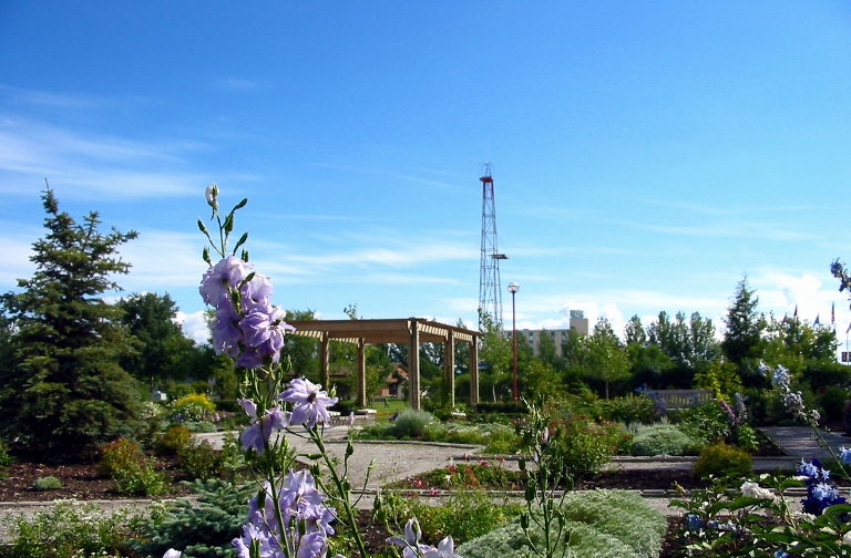
Teaser photo credit: Park in Fort St. John. By Qyd – Own work, CC BY 3.0, https://commons.wikimedia.org/w/index.php?curid=3109062