Originally published on Onearth here.

IN THE FAST LANE After decades of sprawl-induced gridlock, L.A. is now poised to become a mass-transit city. Photographs by Thomas Alleman.
The capital of sprawl, gridlock, and ill-gotten water seeks redemption.
In the summer of 1998, my wife and I left Brooklyn and gamely headed west to Los Angeles, as disaffected New Yorkers are wont to do, in search of the proverbial greener grass. We found it right away in front of the quintessentially L.A.–style rental house we had been dreaming of: a cozy 1920s Spanish Colonial Revival, complete with a yard and a bounteous garden.
One day shortly after we moved in, I found myself standing in this garden with a flowing water hose in my hand. I happily made my way from the brilliant birds of paradise to the pink-petaled bougainvillea to the explosive blue hydrangeas to the dripping honeysuckle vines, giving all a proper soaking before completing the circuit at the base of the lemon tree — our own lemon tree! — right outside our door. I marveled at the quality-of-life upgrade we had been granted as I drenched this lucky tree’s gnarled roots, nourishing them with a stream of life-giving water that had traveled all the way from … from … where had it come from again, exactly? I had to admit that I didn’t really know.
My reverie was interrupted by the staccato song of L.A.’s official bird, as a pair of choppers hovered overhead, idling noisily before zipping off in the direction of the nearby 10 Freeway. A few minutes later I went inside and flipped on the evening news. The helicopters, I learned, had been tracking the progress of a suspect who had led police on a zigzagging car chase from one L.A. freeway to another over the past hour. Aerial footage showed his vehicle slowly making its way through a sprawling asphalt landscape that didn’t look as if it could even be on the same planet as the lovely garden I had just finished tending. I looked out the window: there was my green grass, my well-watered garden, my lemon tree. I looked at the television: there was a never-ending freeway jammed with cars, lined with nondescript strip malls, marked by menace.
Like countless others before us, we had been lured to Los Angeles by a mythic sales pitch depicting sunny skies, palm trees, ocean breezes, new creative opportunities, and the freedom to stretch one’s legs and move about. But quickly we would come to appreciate an inescapable irony: the pitch had proved too effective. So many had heard it and heeded it over the years that Los Angeles had become a standing-room-only Shangri-la. We were free to move about, all right — on traffic-clogged roads that made the "freedom" of driving feel more like indentured servitude. Our fantastical garden oasis was surrounded on all sides by drab, squat, utilitarian apartment complexes. Remarking on the lack of attractive public green space in our neighborhood, my wife noted sardonically that we had to drive somewhere if we wanted to take a walk.
But if there’s one city in the world that knows anything about reinvention, it’s Los Angeles. Our house happened to sit only a few blocks from the site of the movie-studio back lot where teams of brilliant production designers had once transformed a small patch of Southern California into the antebellum South, first-century Jerusalem, and the Land of Oz. Today there are equally creative, equally dedicated teams of individuals attempting to make Los Angeles into a very different place — but not a place out of the past or a children’s fantasy book. These people are hoping to turn it into a better, more sustainable version of itself, one that will be able to meet the formidable water, air, and climate challenges the twenty-first century is sure to throw its way. With the whole city as their back lot, they’re designing the L.A. of the future.
In the beginning, by nearly all accounts, the swath of land settled by the 44 pobladores who founded the city of Los Angeles in 1781 was positively Edenic. These first settlers (largely of Spanish, African, or Native American extraction) arrived at a designated plot beside the rushing, trout- and salmon-filled Porciuncula River and began erecting their new town, on orders from the Spanish colonial governor.
Try to imagine what greeted them: the wide river, with its deeply wooded floodplain; an abundance of wildlife, including antelope, deer, and grizzlies; swamps and marshes where waterfowl loved to congregate; from the west, the salty kiss of the Pacific Ocean’s breeze-carried scent; to the north, views of tall, majestic mountains. Though the discovery of gold in 1849 made San Francisco the odds-on favorite to become California’s lodestar city, the population of Los Angeles continued to grow, from about 5,000 to more than 100,000, during the last half of the nineteenth century. By 1920 (right around the time that four brothers named Warner were cementing the deal on a lot on Sunset Boulevard, from which they hoped to produce their next batch of popular moving pictures), L.A. had overtaken its sister by the bay. San Francisco was home to half a million souls. But Los Angeles was home to 70,000 more.
As the American Eden began filling up, the powerful cluster of city managers, newspaper owners, oil tycoons, and real-estate developers who jointly mapped the city’s destiny from behind closed doors looked around and fully grasped the seriousness of the situation. First and foremost, they realized that, like any garden, theirs would need a steady and dependable supply of water. Second, if Los Angeles were to continue to attract newcomers who desired the unique version of urban living it could provide, the city would need to stretch out, not build up; its appeal was directly tied to the way it didn’t resemble the crowded corridors and vertical cityscapes of a Manhattan or a Chicago. And finally, as a function of this decision to stretch out, L.A. would need to place its bet on the ascendant culture of the automobile.
In the end, these men got Los Angeles its water; they found the city its thousands of acres of developable land; they gave it its car culture; they designed its elaborate stitchery of connecting freeways. But the Faustian bargains they had to strike in pursuit of these goals meant that the city also got a host of damnable problems to go along with them. Los Angeles got desperately thirsty, bitterly angry neighbors upstate. It got metastasizing sprawl, immortalized in satirical folk song lyrics as little boxes on the hillside, all made out of ticky-tacky, all looking just the same. It got the traffic jams and choking smog that kept Johnny Carson’s monologue writers awash in "beautiful downtown Burbank" jokes for 20 years. By the last few decades of the twentieth century, the city itself seemed stuck in an existential traffic jam of its own devising. And in true Hollywood blockbuster fashion, climate change had introduced a ticking-clock element to the whole affair. Like clean water and clean air, time was running out.
* * *
Roman Polanski’s Chinatown, which many regard as the greatest movie ever made about Los Angeles, hit theaters in 1974. Robert Towne’s Oscar-winning screenplay updated the cynical worldview of classic film noir for a post-Vietnam, post-Watergate American moment when practically every voter in the country felt like an unindicted co-conspirator. In the film, Los Angeles private eye Jake Gittes (played by Jack Nicholson) accepts a simple job tailing a man whose wife believes him to be cheating on her, only to uncover a conspiracy that leads him straight to the heart of the city’s power structure.
Towne had based this conspiracy on a real, and still controversial, chapter in Golden State history: the 1913 diversion of massive amounts of freshwater from east-central California’s Owens Valley to Los Angeles and the building of the Los Angeles Aqueduct. The city as we know it would not have come into existence without this marvel of civil engineering and the water it delivered. But if every creation myth comes with its own singular act of original sin, then a great many Californians still regard this brazen resource-grab as the tainted apple that sullied the garden of L.A.
Today, the nearly four million residents of Los Angeles still get more than a third of their water from the aqueduct. Other sources include the Metropolitan Water District of Southern California, a regional cooperative of water districts that pool their efforts to provide a steady supply to L.A. and other members via the Colorado River Aqueduct, and the State Water Project, which brings water down from the Sacramento–San Joaquin Delta via the California Aqueduct. Taken together, these sources represent about 90 percent of L.A.’s total intake. The remainder comes courtesy of local groundwater and recycling efforts.
William Mulholland, the city’s water commissioner during the first years of the twentieth century, is the man generally credited with the idea for the Los Angeles Aqueduct and the vision for seeing it through to its completion. Before that moment arrived, back-room deals were struck between Los Angeles and land developers in the then-unincorporated San Fernando Valley to the north, deals that would further divert the aqueduct’s water to thousands of just-purchased acres, enriching a handful of insiders and setting those acres up for future annexation by the city. Frustration over such secretive deal-making and the rapid drying out of the Owens Valley helped launch the "California water wars," marked by semi-regular attacks on the aqueduct throughout the 1920s, sometimes involving dynamite.
On a 72-degree day this past February, a friend and I decided to make the half-day’s drive from Los Angeles to see the exact spot where the Owens River ends and the Los Angeles Aqueduct begins. As chance would have it, our trip took place almost 100 years to the day after Mulholland stood on the aqueduct’s intake platform and gave the order for three large wheels to be turned, an act that effectively redirected the flow of river water into a man-made trough that would twist and wend for 233 miles — carried only by gravity the entire way — until it reached its cascading terminus within L.A.’s city limits.
Near the town of Lone Pine, we stopped to gaze at the poignantly mislabeled Owens Lake, a 100-square-mile salt flat that resembles nothing so much as a gargantuan lunar crater. The rerouting of the river that had fed into the lake for eons caused water levels to drop so precipitously that by 1926 Owens Lake was gone. Today the dried-up lake bed holds the distinction of being the single largest source of dust pollution in the United States. Strong winds blow more than 75,000 tons of noxious alkali powder off the mostly dry lake bed each year. The Los Angeles Department of Water and Power (LADWP), which has administrative control over the aqueduct, must now use fully half of the water it pumps out of the valley — 30 billion gallons every year — just to tamp down dust.
At the tiny Eastern California Museum (in the almost-as-tiny town of Independence) we got directions to the unmarked turnoff on Highway 395 that would lead us to the aqueduct’s intake platform. I was shocked — given what I knew about the ferocity of the water wars — to be able to drive right up to the site without having to flash an ID, explain my reasons for wanting to see it, or even pass through a gate or manned checkpoint. It was just right there, waiting for us, at the end of a short, dusty stretch of road.
We stood on the platform and snapped some photos. I admired the view of the snowy Sierras for a moment before turning my gaze to regard what was technically the last marshy bend made by the rolling Owens River before it was transmuted — where I stood — into a wholly owned piece of LADWP infrastructure. I imagined the sound of an infant’s cough during an alkali dust storm. Mentally I tried to estimate the number of Beverly Hills swimming pools that went largely unused. And I thought about that evening 15 years before, when I had watered my front lawn without any real thought as to whether my plants actually needed a drink — even though I must have known, on some dim level, that every last drop coming out of my hose had been sucked from someplace far away through a system of very long, very expensive straws.
* * *
We drove back to the city, gliding through a mostly empty countryside until we hit the exurbs of Palmdale and Lancaster, where the sudden preponderance of housing developments and big box stores and fast food franchises combined to form a gaudy mirage that made me think we were already home, when in fact we were still a good 60 miles out. We had penetrated the sprawl line.
Practically anyone who has ever flown into Los Angeles International Airport has experienced the shock of peering down from a window seat and suddenly realizing what sprawl, real sprawl, looks like. From a few thousand feet up, it looks far less like anything having to do with the physical organization of human civilization and more like a semi-intelligent form of invasive vegetation: a sinister, stucco kudzu.
But the aerial view misleads — sort of. Most people associate the idea of sprawl with low density: single-family homes and strip malls spreading out beyond the horizon. Yet when the results of the 2000 United States census were released, many were surprised to learn that Los Angeles was actually the most densely populated metropolitan area in America. In fact, as Eric Eidlin, a community planner from the San Francisco Bay Area, has observed, the so-called Southland (representing the greater Los Angeles metropolitan area) "has been the densest urbanized area in the United States since the 1980s." In terms of people per acre and jobs per acre — the standard measures of density — L.A. blows the metropolitan areas of New York, Chicago, and San Francisco clear out of the water.
How can this be? The answer, Eidlin explains, is that the Southland has "both a relatively high density and a relatively even distribution of density throughout its urbanized area," making it uniquely cursed. This particular combination means that it "suffers from many of the problems that accompany high population density, including extreme traffic congestion and poor air quality, but lacks many of the benefits that typically accompany more traditional versions of dense urban areas, including fast and effective public transit and a core with vibrant street life."
What the urban theorist William Fulton has termed "dense sprawl" diffuses human activity in the Southland, pushing it away from what would in most urban areas be the core of a downtown and into any number of equally dense communities. Thus does the region find itself in a singular situation as it struggles to improve air quality, reduce emissions, and stretch resources over a swath of land that’s roughly the size of Indiana, with a population roughly the size of Florida’s.
Los Angeles’s vision of itself before World War II was naively utopian: We can keep taking, keep growing, keep driving, and any problems we might encounter along the way will be easily handled by future generations of experts and scientists! The psychographic snapshot at midcentury — when smog levels shut the city down for an entire month in 1954, and when wildfires swept down from the hills into the tony neighborhoods of Bel Air and Brentwood, incinerating the homes of movie stars — was decidedly more nervous.
The contemporary vision is science based and clearheaded. But it is also creative and hopeful. Three bold plans for decreasing L.A.’s need for distantly sourced water, reducing its reliance on the single-passenger automobile, and reshaping its communities to mitigate the ill effects of sprawl represent not only a change in the way the region will look and function over the century to come but an equally dramatic shift in how its millions of residents are coming to perceive themselves.
* * *
For 20 years, Jonathan Parfrey has been planning for this impending shift, first as the local director of Physicians for Social Responsibility and later as the executive director of the Green LA Coalition. Recently Parfrey founded Climate Resolve, an advocacy and outreach organization dedicated to putting L.A. at the top of the list of cities fighting climate change by adopting sustainability as its way of doing business. In 2009, he was appointed to the Los Angeles Board of Water and Power Commissioners, and it was the city’s water-sourcing future that I wanted to discuss when I met him for breakfast in February. Over scrambled eggs at Philippe’s — at 105 years old, this downtown dining spot almost certainly served William Mulholland a French dip sandwich or two — Parfrey explained how LADWP is paying an unusual form of tribute to Mulholland and his contemporaries by casting L.A. as "the city of the future," just as the city fathers once did.
Thanks to major improvements in conservation, water recycling, and the capture and reuse of stormwater, Parfrey told me, 25 years from now Los Angeles will be getting 37 percent of its water supply from — of all places — Los Angeles. The impact of conservation has already been made clear: in 2009 the city began requiring that residents limit their sprinkler use to certain days of the week and implementing a new system of tiered pricing; overall, water consumption fell by 20 percent. But the gains that will be achieved through recycling and capture, Parfrey said, will prove to be every bit as crucial.
LADWP’s most recent Urban Water Management Plan, released in 2010, codifies the steps that will need to be taken to get to the 37 percent goal and attaches estimated gains — and dollar values. Citing one example of a major opportunity just waiting to be exploited, Parfrey said that the Hyperion sewage treatment plant (on Santa Monica Bay, just below LAX) currently dumps an average of 350 million gallons of primary treated wastewater into the Pacific every day. Pipes leading to a nearby facility where that water could be further treated before re-entering the city’s water system simply can’t handle the capacity. "This is water that might have come all the way from the Wyoming Rockies, down the Green River to the Colorado," Parfrey said. "Or it may have come down from Mount Shasta, through the Bay-Delta and over the Tehachapi Mountains via the world’s highest water conveyance." Yet after putting so much effort and energy into getting it to Los Angeles, "we use it once, and out it goes."
The current plan calls for massively increasing the outflow capacity of facilities such as Hyperion through the fourfold expansion of LADWP’s system of "purple pipes," which carry treated wastewater to sites where it can be used in a variety of nonpotable settings, such as parks, golf courses, nurseries, cemeteries, and carwashes. Another avenue LADWP is exploring would resuscitate the San Fernando Basin, a highly contaminated aquifer in the San Fernando Valley, by injecting it with captured stormwater and then treating the blended result as it is pumped out, in a process known as wellhead treatment.
Parfrey has operated in Los Angeles environmental circles long enough to know how hard it can be — even in this Prius-driving, yoga-practicing, organic-kale-munching town — to get citizens excited about paying new taxes and higher utility rates, or about workmen digging up their streets and sidewalks to install those purple pipes. But, he asks, if the city doesn’t make those investments, what happens if a major earthquake destroys the aqueduct? Or if the Colorado River dries up because of climate change? Or if there’s lighter and lighter snowpack in the Sierras? "For L.A. to be viable," Parfrey said, "we need more options in terms of water supply. What better option could there be than the one that is literally beneath our feet?"
* * *
The man who appointed Jonathan Parfrey to his water commissioner’s post — the Honorable Antonio R. Villaraigosa, the 41st mayor of Los Angeles — was running late. Those of us who had crammed into an overflowing classroom at UCLA to hear him speak about the future of sustainable cities were starting to wonder what was up.
The reason for the mayor’s delay, it turned out, was predictable: traffic. After arriving, Villaraigosa grimly joked that the sirens and rotating blue emergency lights he and his fellow big-city mayors are entitled to use whenever they’re in a hurry are all but worthless in his hometown. If the folks in front of you can’t move, they can’t move.
When it comes to getting from City Hall to UCLA, however, future mayors (including the just-elected Eric Garcetti, who will be sworn in this July) will have a better and faster option. And they’ll have Villaraigosa, in large part, to thank for it. Once the $6 billion, nine-mile west side extension of Metro Rail’s Purple subway line is completed (best guess: 2035), the next-to-last stop will be just a short walk from the UCLA campus. The pairing of this extension with an extension of the Expo light-rail line to its south — a line that will end just a few blocks away from the the Pacific Ocean in Santa Monica — represents both an engineering triumph and a political miracle.
The network of subway and light-rail lines collectively known as Los Angeles County Metro Rail began to take shape in the mid-1970s as that decade’s national gasoline shortage, combined with local frustration over worsening air quality, convinced the people of Los Angeles that the time had come for modern, rail-based rapid transit. Since 1990 Metro Rail has grown to be an impressively wide-reaching, if still underutilized, component of a larger mass-transit network that successive mayors have all helped expand to varying degrees — but none of them with the energy of Villaraigosa.
The city’s first Latino mayor since the 1800s has been widely praised for his skill in marshaling different constituencies toward his mass-transit goals. "There’s a developmental arc to his leadership," said Denny Zane, the former mayor of Santa Monica, describing to me his admiration for the way Villaraigosa brought his base of Latino voters — for whom mass transit was as much about getting across town to work as it was about cutting greenhouse-gas emissions — together with influential environmentalists he had won over during a protracted courtship that began before he even took office. Basically, Villaraigosa made both groups (and others, too) see how transit could serve as a political bridge. "By merging the Latino community’s aspirations for justice and opportunity with the environmental community’s aspirations for clean air and clean water," Zane said, "he became the natural leader for the transit revolution."
In fomenting this revolution, Villaraigosa had help from Zane, who, as executive director of the transit advocacy group Move LA, was a principal architect of Measure R, the 2008 ballot measure that proposed funding $40 billion worth of transit projects with the aid of a countywide half-cent sales tax increase. When Villaraigosa announced on the heels of Measure R’s passage that he had won federal approval for a special financing plan that would allow him to fast-track 30 years of projects into a 10-year window, Angelenos realized just how serious he was about making transit the cornerstone of his legacy.
At UCLA, Villaraigosa acknowledged the political resistance he had encountered — from both the right and the left — as he implemented one transit initiative after another: from congestion pricing on area freeways (in the form of high-occupancy toll lanes), to his plan to add 1,680 miles of bikeways to the city over the next three decades, to his push for bus rapid transit on Wilshire Boulevard, a major east-west thoroughfare that runs 16 miles from downtown Los Angeles to the Pacific Ocean. "The only way you’re going to get people out of their single-passenger automobiles," Villaraigosa told us all shortly before rushing off to his next appointment, "is to remake the city."
To do something as grand as remaking a city requires political leadership, to be sure, but it also requires something else: a comprehensive, time-release public policy that allows a plan to grow and adapt over years, or even generations, until its goals take on the organic quality of shared civic ideals. Such was the thinking behind the Sustainable Communities and Climate Protection Act of 2008, better known as SB 375. The purpose of the law is to reduce greenhouse-gas emissions in the state, but it also has the potential, if implemented thoughtfully, to do much more.
SB 375 was actually conceived as a means of helping Californians carry out the goals of another law. AB 32, which passed in 2006, required the state to reduce its greenhouse-gas emissions by nearly a quarter, returning them to 1990 levels by the year 2020. The Natural Resources Defense Council (NRDC) had worked closely with legislators on designing the bill — and with one state assemblywoman in particular, Fran Pavley, to help push it through the legislature. (NRDC is the publisher of OnEarth.) But as Amanda Eaken, a senior policy analyst with NRDC specializing in land use and transportation, has put it, as groundbreaking as AB 32 was, it still "didn’t tell people how to do it."
Studies had shown that passenger vehicles accounted for about 30 percent of greenhouse gases emitted statewide; California laws that regulated tailpipe exhaust and established higher fuel standards acknowledged this fact. But what they hadn’t acknowledged was the relationship between emissions from passenger vehicles and sprawl.
As Eaken told me, while past laws might have done wonders for making this particular car or that particular truck more efficient, they hadn’t addressed the fact that "as our urban areas continue to expand, the amount of driving that’s required continues to go up."
NRDC, partnering with the California League of Conservation Voters and others, saw the opportunity for a new law that would finally bring crucial issues of land use and transportation policy into the discussion. NRDC became an energetic backer of SB 375, which was sponsored by State Senator Darrell Steinberg and eventually signed into law by Governor Arnold Schwarzenegger in 2008.
But given the differences among California’s population centers in terms of size, geography, climate, demographics, and other factors, the only way for lawmakers to make SB 375 politically tenable had been to grant the state’s different regions — the Bay Area, the San Diego area, the greater Los Angeles area, and others — maximum flexibility in reaching its targets. In the Southland, a regional consortium known as the Southern California Association of Governments (SCAG) — whose 84 voting members represent 19 million people living in 191 municipalities — was vested with this authority.
At first, recalled Hasan Ikhrata, SCAG’s executive director, his members, who are rarely of one mind about anything, were of one mind about SB 375. "They were unanimously opposed to it," he told me. But over time, as Eaken and other SB 375 proponents worked to shift the conversation from what new regulations the law might impose on their communities to what new cost-savings and development opportunities it could present, SCAG members — even those from politically conservative Orange County, where they named the airport after John Wayne — came aboard, one by one. As Ikhrata recalled, "It went from, ‘Oh my God — what’s this bill going to do to me?’ to ‘This bill could really be helpful to me and my city and the people I represent, because the future is clearly going to be different.’"
In April 2012, SCAG surprised everyone by announcing that its 84 constituent members had just approved, unanimously, a $524 billion plan to implement SB 375. Among other things, the plan calls for $246 billion — nearly half of its overall funding — to go specifically toward public transportation projects in Southern California, from the creation of new bus rapid-transit lanes and light-rail lines to the expansion of L.A.’s subway system. An additional $6.7 billion is earmarked for projects encouraging Southern Californians to choose bicycling and walking over driving. SCAG members also agreed to increase the quantity of housing near transit by 60 percent within their respective communities, and to find new ways of bringing businesses and transit closer together. The Los Angeles Times lavished praise on SCAG’s plan, describing it as "a model of sustainability."
* * *
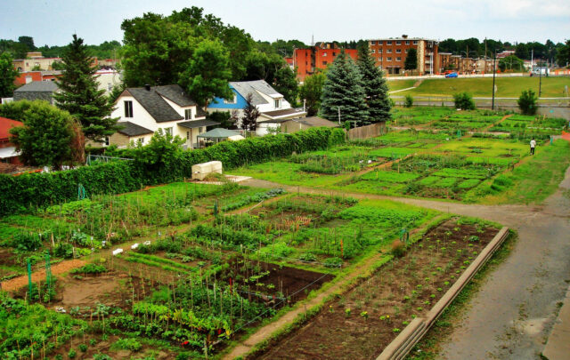
According to SCAG’s Sustainable Communities strategy, by 2035, 87 percent of all Southern California jobs will be located within a half-mile of some form of public transportation. The Heirloom Bakery and Café in South Pasadena already is. The busy and beloved breakfast and lunch spot sits about 100 feet from a Los Angeles Metropolitan Transit Authority’s Gold Line stop, where light-rail trains pick up commuters heading downtown and drop off the many people from all over L.A. who flock to South Pasadena to soak up its picturesque, small-town charm.
South Pasadena is, not coincidentally, a model of "transit-oriented development" (TOD), the urban-planning term for commercial and residential development that exists in a mutually beneficial state of symbiosis with one or more modes of public transportation. I had come to the Heirloom Bakery to meet Michael Woo, a former member of the Los Angeles City Council and the current dean of the College of Environmental Design at California State Polytechnic University, Pomona. We sat outside and enjoyed our breakfast in the T-shirt weather of a typical San Gabriel Valley February, having to speak up only slightly whenever a bell rang and the railway crossing’s white bars descended to halt car traffic and let another Gold Line train through.
Woo, an urban planner by training, was an early booster of SB 375 and, by virtue of his university’s location, often found himself singing its praises in various corners of the culturally conservative Inland Empire area east of Los Angeles. In the early days, he told me, he kept encountering a certain recalcitrance, especially from business leaders. "Their assumption was that the past prosperity of the Inland Empire was actually based on sprawl, on construction jobs, and on the high-wage, low-skill jobs of the logistics and shipping and transportation industries," he told me. "For them, a smart-growth approach not only didn’t fit; they saw it as directly undoing what they had accomplished in the past."
Woo suspects that their fear of change was rooted in deeply held beliefs about how to define the word progress. "A lot of them may have been refugees from other cities who thought that by moving to L.A. they were getting away from the worst aspects of dirty, old, unsafe transit systems," he said. "Many of them believed that low-density living, automobile dependence, a culture based on private backyards instead of public open spaces simply reflected the L.A. version of the American Dream. They were reluctant to embrace transit or density as part of the solution. To them it all just seemed like going backward."
As someone whose City Council experience involved drawing transit routes and designing TOD hubs, Woo hopes planners won’t lose sight of the big picture. Development decisions have to be made in a way that minimizes the displacement that can come from gentrification, he said. And then there’s the nagging problem of how to get Angelenos from their houses and offices to those transit nodes that are going to make their lives easier, the air cleaner, and the planet cooler. "How likely is a person to take the subway if he or she has to get in the car and drive two miles just to get to the nearest station?" he asked me. "What if they can’t park once they do get there?" Aren’t they more likely, in other words, just to stay in their car and keep going?
Still, Woo told me that he believes attitudes in and around Los Angeles have at last fundamentally changed — about the need for mass transit, the need for dense development, and the need to link the one with the other. When decades-old political opposition to a subway along Wilshire Boulevard can be overcome; when overtaxed Angelenos can be convinced to support a half-cent sales tax increase for funding transit measures; when conservative SCAG members from the Inland Empire and Orange County, for Pete’s sake, are among SB 375’s most vocal supporters, we can all stipulate that the game has, officially, changed. As Woo put it, with a smile on his face and a Gold Line train rushing behind him, "The dominoes are falling."
* * *
They still arrive in Los Angeles every day, just as they’ve done every day for well over a century now: people hoping to make or remake something of themselves.
Maybe they’re aspiring actors or musicians, counting on the city’s no-questions-asked policy to aid them as they morph into the next Marilyn Monroe or Marilyn Manson. Maybe they’re immigrants from El Salvador or Mexico or Korea or Russia or Israel or any one of the scores of "old countries" that the vast majority of Angelenos remain tied to, directly or indirectly, through bonds of language and custom and (fortunately for L.A. diners) cuisine. Maybe they’re just Americans who came from other less exciting, less sunny places: people with no celebrity aspirations or special exigencies, people who simply like the idea of moving someplace where creativity trumps pedigree, where you might see a movie star at the grocery store, and where you don’t have to shovel snow anymore.
But from now on, they’ll be coming to a different city. The capital of starting over is starting over. If Los Angeles follows through on its promise to change the way it consumes resources such as water and gasoline, if its citizens are in fact serious about nurturing their urban landscape with as much care as they’ve historically put into their front-yard landscaping, then this place famous for the way it has always welcomed dreamers of all kinds will be, indisputably, far more welcoming. And among the dreams it yields will be the dream — eminently realizable — of even better things to come.