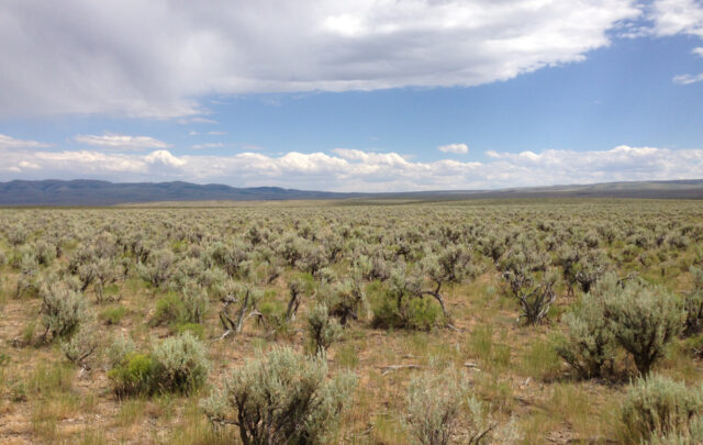
Marrero, LA–An impending crisis that could have a detrimental impact on the oil and gas infrastructure and fishing industry in the United States is leading scientists to investigate how to stop rapid deterioration and to start restoring marsh land in Louisiana’s southern coastal wetlands-which are losing a piece of land the size of a football field every 35 minutes. All of this is part of an international broadcast expedition wrapping up conclusions and coming to an end in the Louisiana bayou with the JASON Foundation for Education.
“The loss of Louisiana’s wetlands is the single most catastrophic environmental disaster ever to hit the continental U.S.,” said Mark Schexnayder, a marine biologist with the Louisiana State University Agricultural Extension and Research Center-Sea Grant Program. “The consequences of loosing the wetlands are far reaching and affect everyone. Of course there are biological and ecological effects, but the biggest cost of losing the wetlands will be on oil and gas prices, causing them to rise everywhere. The oil production rigs and natural gas pipelines in Louisiana depend on the wetlands to protect their structures from storms and hurricanes. Without the wetlands, they are exposed.”
With environmental lessons from Asia’s tsunami disaster lingering weeks later and the vigorous 2004 summer of hurricanes, Louisiana’s coastal wetlands are one of the most protective barriers against such disasters and account for over 40 percent of the total salt marshlands in the United States.
“Wetlands act as a storm buffer for hurricanes and other large storms,” said Dr. Denise Reed, a professor of Geology and Geophysics at the University of New Orleans. “With the rapidly depleting wetlands, people that have lived in southern Louisiana can tell that over the last 30 years, large storms now come in faster and the water rises faster, which gives less time to respond and less time to evacuate. In the next few years, it’s going to get worse.”
“The land is literally gone. Some people use the term ‘the sky is falling,’ but here the land is falling,” Schexnayder said. “Everyone saw last summer how hurricane Ivan shot up oil prices after damaging a few oil rigs, and it didn’t even have a direct hit. There’s no telling how high the price of oil will go years down the line if a severe hurricane directly hits and there are less wetlands to protect the energy infrastructure and the coastline. Besides losing the oil, you’d also face the price of repairing broken pipelines, huge loses in shrimping and fishing and restructuring the whole shipping industry in New Orleans, one of the largest ports to receive goods in the United States. It would cost billions and billion of dollars.”
Working at Jean Lafitte National Historic Park, Barataria Preserve and Louisiana Universities Marine Consortium (LUMCON) facilities in Cocdrie and Port Fourchon, LA – expedition scientists are looking at how marsh subsidence (the shrinking down and compacting of soil) along with levee construction, grazing by nutria (large rodents that feed on wetland plants) and other factors all contribute to a rapid loss of wetlands.
“It’s a sum total of all these things working together and not any one thing alone,” said Reed. “We know that wetlands survive naturally and have been for thousands of years, but it has only been since the beginning of the 20th century that we have introduced these multiple factors and human factors so that now the natural processes are disrupted.”
“It’s only in the last few years that we have gotten a handle on the rate of subsidence. We’re starting to get a better idea of how this happens and how fast these things happen over time. The wetlands around New Orleans are so degraded that they provide little or no protection against large storms,” Reed said. “Only a major restoration project can really help bring back those wetlands.”
This research program is part of JASON Expedition (formerly JASON Project), a middle school program designed to engage students in science and math by partnering them with real scientists. Using satellite broadcasts and Internet technology scientists in the field are linked with classrooms and educational institutions to allow students to interact with the JASON Expedition team in real time and receive a first-hand look at how real wetlands research is collected.
Participating JASON schools around the world are playing an active role in the research by using NASA’s International Space Station (ISS) Earth KAM camera to identify and to take their own photographs of wetlands from space. Students have direct access to and control of a digital camera flying on board the International Space Station and can download their wetland images within a few hours after being taken to enhance their understanding of wetlands loss.
Students and the general public can see how human activity and natural processes can destroy or build wetlands at www.jason.org with an online “digital lab” that allows users to manipulate those processes by polluting the Gulf, simulating a hurricane, creating natural subsidence, making the sea level rise, and more. With the flip of a switch or crank of a wheel, participants can simulate what happens over a 1,000-year period by creating different scenarios and combinations of human and natural processes that affect wetlands.
“The expedition engages students in real science, not just textbook theory,” said explorer Robert Ballard, founder of the JASON Foundation for Education and best known for his discovery of the Titanic. “These students are conducting wetland experiments in their own communities, so they can determine the health and vitality of wetlands in their area.”
“The most important thing people can do to help save and possibly restore the wetlands is to go out and learn what the problems are. They are different for all wetlands,” said Reed. “One side of Louisiana doesn’t have the same problems as the other side of Louisiana. We may never get back the wetlands we have lost, but we are working to maintain them and go back to those natural processes.”
“You don’t even have to read a book, just look at a map to see how the wetlands are vanishing,” Schexnayder said. “It will probably take a natural disaster to grab everyone’s attention. It’s the old pay now or pay later scenario. But the bottom line is that it’s easier to save than rebuild.”
To follow the JASON expedition’s exciting research, visit www.jason.org for daily updates. The JASON Foundation for Education is working collaboratively with the National Park Service, Louisiana Universities Marine Consortium (LUMCON), Barataria-Terrebonne National Estuary Program, NASA, National Oceanic and Atmospheric Administration and colleges and universities around the world.
###
The JASON Foundation for Education, based in Needham, Massachusetts, is a non-profit organization dedicated to providing new ways of teaching and new tools for learning middle-grade science and math through innovative, technology-rich educational and professional development programs.