In British Columbia, stewards from the Heiltsuk First Nation are using computational models and Indigenous knowledge to protect bears’ access to salmon.
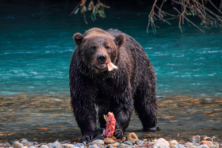
From late summer to fall, the grizzly and black bears of British Columbia’s Central Coast embark on an epic grub crawl, moving from stream to stream to feast on spawning salmon. Packing on the pounds is good for the bears, of course, as it helps them survive the winter. But being the Canadian equivalent of the king of Fat Bear Week takes more than a keen eye and quick paws. Making the most of this annual glut of fish also requires being able to deftly navigate the best paths between streamside banquets.
But how do bears make their way from smorgasbord to smorgasbord? That’s not a simple question to answer—but doing so, says William Housty, the executive director of the Integrated Resource Management Department for the Heiltsuk First Nation, could help people make bears’ lives much easier. And not just bears, Housty adds: “We consider the bears an umbrella species. If we protect the bears and bear habitat, we are also protecting wolves, cougars, and every other little four-legged mammal out there.”
The Heiltsuk have a long history of protecting bears on their Central Coast territory, which at 5,618-square-kilometers (2,170-square-miles) is almost three times the size of the Hawaiian island of Maui. Despite the bears’ ecological and cultural significance, Housty says the B.C. government’s understanding of how the animals move through their territory is completely unrealistic. The provincial government uses satellite data to map bear habitats, rather than field studies, and doesn’t explicitly consider how bears travel between them. “How does a bear get from A to B?” Housty says. “According to the provincial maps, it must fly.”
To develop a more realistic picture of how bears crisscross their territory, Housty and other Heiltsuk stewards recently partnered with academics to construct their own model of bear navigation. Their tool, which is based on a technique borrowed from electrical engineering called circuit theory and has been adapted for use in landscape ecology, gives them a way to calculate the “least cost” pathways that the bears might take to navigate the complex and densely packed forest between salmon streams.
Traditionally, circuit theory is used to represent electrical circuits, and to help calculate how electrons navigate a complex system of resistors. In this case, the electrons are bears, and the resistors are dense old-growth forest, previously logged areas, tidal inlets, and a rugged landscape prone to snow and ice. Male grizzly bears, the farthest-roaming travelers, have ranges that can span 130 square kilometers (50 square miles) or more, so are particularly likely to encounter a wide variety of landscapes and navigational challenges.
To build their model, the Heiltsuk used their knowledge of bear movements garnered from DNA samples of bear fur collected across the territory, community interviews, and the Heiltsuk Traditional Use Study, which started gathering oral histories and traditional knowledge from Heiltsuk elders in the 1990s.
Because the Heiltsuk fed the model a veritable trove of Indigenous knowledge, they are confident of its findings. “We control the data that went into it, and had ground truth on a lot of that data,” Housty says.
That reliance on Indigenous knowledge is one of the project’s strengths, says biologist Michael Proctor of the Canadian ecological consulting firm Birchdale Ecological, who wasn’t involved in the effort. “They are the ones who know the region best in this case,” Proctor says. In his own work, Proctor used circuit theory to identify how bears navigate the Canada-United States border region.
The Heiltsuk’s movement model considers all the challenges bears face as they wind their way through their habitat, including obstacles created by people. Recently logged regions, for instance, which grow into dense thickets of small trees and shrubs, can pose greater navigational challenges for bears compared with more mature forests.
On the whole, the bears living in the Heiltsuk’s sparsely populated territory have it pretty good. Threats to the bears’ lives and livelihoods are quite low. But the Heiltsuk’s goal in identifying the bears’ best navigational pathways is to help protect these corridors from future activities that would destroy them, such as logging or other extractive developments.
“Connectivity research is typically done in landscapes that have already been degraded,” says Ilona Mihalik, a graduate student at the University of Victoria and the study’s lead author. “This approach advocates for taking action before it is too late.”