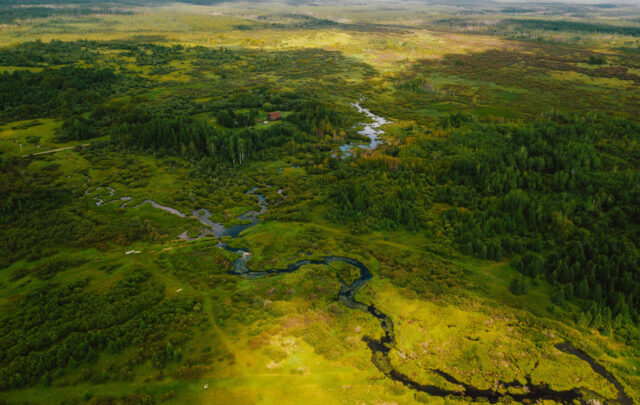
The famous canals of The Netherlands are not just unique tourist attractions. They are water control systems that help the Dutch in their battle against the ever-encroaching North Sea. Now this tiny country is faced with a new, more grave challenge: rising seas caused by climate change.
“Climate change leaves us with no way back,” said Renée Jones-Bos, ambassador of The Netherlands to the United States. “We must rethink our cities and inhabitants because climate change is shattering any notion of having water under our control. We must realize that we can’t use any land for any purpose.”
She spoke recently at the annual conference of the American Planning Association (APA) in New Orleans about “Delta Urbanism,” her country’s new concept of water control for cities located on deltas.
Delta urbanism addresses the water landscape as well as flood risk mitigation, urban design, green buildings, green roofs and climate proofing and other technologies that cope with sustainability and resiliency issues.
“The key is sophisticated, integrated water management and sound urban planning,” said Jones-Bos.
She went on to say that because international cooperation and collaboration produce better ideas and solutions for these difficult problems, the Dutch have initiated dialogues with engineers, urban planners and designers, landscape architects, and soil/hydrology experts in several delta cities of Europe and the United States as well as with Jakarta, Ho Chi Minh City, Hanoi, Taipei, Taiwan and Orangestad, Aruba. Participants also swap ideas about taxing residents and occupying new lands for increasing populations that are expected to create the new global problem of accommodating “climate refugees” who must escape land taken over by rising sea levels.
In fact, the Dutch were among the first to come to the rescue of New Orleans after Hurricane Katrina’s surge flooded the city and then followed up with a series of meetings called the Dutch Dialogues.
“Thank God for the Dutch,” said Senator Mary Landrieu (D-La.) in a keynote address to the 5,000 planners at the APA conference. They provided “extraordinary expertise when our government failed to understand what happened here” after Katrina.
The first of the dialogues was held in March 2008 to explore if, where and how Dutch approaches to water management, landscape architecture, flood protection and urban design were relevant to New Orleans as it recovered from Hurricane Katrina.
Dutch Dialogues 2 was held in October 2008 and brought together 60 experts to develop illustrative solutions and design approaches that could make the city more flood-proof, sustainable, resilient and attractive from both urban design and economic perspectives.
The Dialogues have been developed, organized and supported by the Royal Netherlands Embassy in Washington, D.C., Waggonner & Ball Architects in New Orleans, the American Planning Association and the Netherlands Water Partners. Numerous local New Orleans organizations and individuals have supported the Dutch Dialogues with monetary and in-kind support.
Water problems in The Netherlands
With 70 percent of The Netherlands vulnerable to flooding in one of the most densely-populated urban areas of the world, the Dutch have struggled to stay high and dry over the past 1,000 years. After much trial and error, they developed a system of dikes in the 13th century, which proved that it was possible to live below sea level in a country the size of New Jersey.
They continued to have major floods but the 1953 flood was the worst with nearly 1,900 people killed and 50,000 buildings destroyed as a result of a vicious North Sea storm. That’s when the government created the 40-year Delta Works storm protection program, which included the construction of 62 floodgates on a 1.5-mile stretch of North Sea coastline. Levees near the delta city of Rotterdam were replaced with storm surge barriers.
Among the considerations that go into planning their systems are the currents and winds that shape the coastline. In the 19th century, they developed dredging technology to provide a coordinated and interconnected dike and drainage system that influenced the spatial organization of their cities. Dams were built, a traffic network was conceived, and dike belts with safety norms were created. Much of this infrastructure was built underground, so in the 1970s the government decided on another approach of flood control for four reasons.
First, the land is sinking and this makes their soil—and their food supply—vulnerable.
Second, their hydraulic infrastructure threatened the ecological habitat of oysters and lobsters so a new type of dam had to be constructed with an open-and-closed system to handle storm surges. This development marked the beginning of a changed mindset where environmental considerations were built into hydraulic designs.
Third, urban waterfront development has evolved from merely maintaining ports to finding relationships between safe buildings and hydraulic technology.
Fourth, climate change was contributing to higher seas in a country where half of it lies one meter above sea level and one-eighth is below sea level. Since 2008, the Delta Committee is helping the government identify the vulnerabilities of the system and find ways to protect it.
Always on the alert for flood control ideas, Dutch planners also discovered that engineers in Hamburg, Germany, are building elevated street systems and closing ground floors in buildings when floods occur. Today, the Dutch are trying to introduce similar flexibilities into their systems, like building houses on pillars and finding places where flood waters can go and be stored. However, these designs will not be sufficient because it is not known how they will work in extreme storms.
“We are trying to work with Nature instead of fighting against it,” said V.J. (Han) Meyer, professor of urban design at Delft University of Technology. “This has caused us to re-vision how we deal with water in urban areas. It has led us to a new program called Vision 2053.”
Vision 2053 approaches flood defense in new ways. Among the proposals are building earth dunes and beaches in front of the existing coastline instead of constructing higher dikes that can be weakened against the power of sea waves.
The Dutch also want to create more water storage areas and water networks in order to provide a new spatial element that binds cities together and denser neighborhood development. Netherlanders would also keep their water rather than throw it away.
Finally, they have begun a new project called Room for the Rivers that would create more space for river water to go in times of high discharge. Over 40 projects are planned (or in progress) and they will greatly influence urban design and architecture.
http://www.verkeerenwaterstaat.nl/english/topics/water/water_and_the_fut…
Meyer indicated that the Dutch strive for a three-layered approach to flood control: concern over the urban life of the city, infrastructure, and the underground. This approach aims to protect and deal with the environment and it shapes the look and functioning of cities.
The American Experience
It is interesting to note that the Dutch plan for “the big one” to occur in 10,000 years while the U.S. Army Corps of Engineers constructed a flood control system for New Orleans to protect against an extraordinarily bad storm occurring only once in 100 years.
Of course, the Netherlands is quite different from New Orleans, said Meyer.
The Rhine River in The Netherlands is a “small creek” compared to the mighty Mississippi, he said, so the Corps’ strategy would be comparable to one storm in 500 years by Dutch standards. Nevertheless, the U.S. Army Corps of Engineers has been working on new strategies and new approaches toward flood control.
One lesson New Orleans has learned is to elevate the houses in low-lying areas, said Richard Campanella, associate director of Tulane University’s Center for Bioenvironmental Research and a research professor with Tulane’s Department of Earth and Environmental Science. The Lower 9th Ward and St. Bernard Parish had floods with depths of 18-20 feet so the “Brad Pitt houses” currently under construction are an example of what can be done to protect these homes.
“It is important that we build a city that doesn’t have to evacuate,” he said.
Another lesson under consideration is about making water planning an integral part of other plans—including regional plans—like organizing space efficiently and sustainably, sharing costs among several governmental entities and boosting civic pride.
“I’ve always believed that we needed a water plan for New Orleans,” said David Waggonner of Waggonner & Ball Architects, New Orleans, in an interview with Planning Magazine (Ruth Eckdish Knack, AICP, August/September 2008).
“People think about the riverfront, but no one is thinking about water connections between the lake, and the river,” he said. “What we need is a strategic vision to inform the master plan. Hearing how the Dutch have turned their water resources into attractive assets is a good thing.”