A cluster of tremors, including the largest recorded earthquake in Alberta’s history, may have been due to oil and gas activity in the region.
In November Earthquakes Canada recorded a tremor registering a magnitude of 5.8 on the Richter scale that shook up a large portion of northwestern Alberta and B.C.
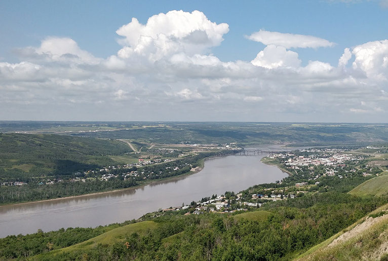
According to the agency the epicentre of the earthquake was about 45 kilometres southwest of the town of Peace River and “was preceded by two 5.2 earthquakes,” and followed by another 14 tremors. According to the provincial energy regulator the events occurred at depths of about six kilometres, which is not consistent with other previous events triggered by oil and gas activity.
Aftershocks continue to shake the region.
Hundreds of citizens and workers as far away as Calgary, Edmonton, Dawson Creek and the Site C Dam felt the earthquake cluster. Other agencies such as the U.S. Geological Survey also reported shaking in the region.
Regulator won’t confirm cause
The Alberta Energy Regulator has stated there is currently no evidence that the activity was induced by fracking but that “further analysis is needed.” Fracking involves injecting sand, water or other fluids into underground rock seams in order to force loose oil or gas or to dispose of contaminated water used in the process.
Gail Atkinson, a specialist in seismic hazards who has studied industry-made quakes in Western Canada, noted that “the cause of this sequence is not yet established, but most events in this region are triggered by hydraulic fracturing, wastewater disposal, or some combination of the two.”
The oil and gas industry operates oil wells in the region and there are numerous well pads near the epicentre of the quake. Around 50,000 of 700,000 oil and gas wells drilled in Alberta are used to dispose of waste or produced water.
The Alberta Energy Regulator did acknowledge wastewater disposal wells in the area. “While there are fluid disposal operations in the region, none are in the immediate vicinity of the seismic events, nor have there been changes in the rates of fluid disposal over the past year,” the AER wrote in an email to The Tyee.
The regulator made no mention that fluid injection can unpredictably cause tremors tens of kilometres away from the triggering drill site. Or that earthquakes can occur kilometres below the injection site. Texas studies show that even shallow waste water disposal can cause deep earthquakes.
Water injection as a byproduct of drilling for oil and gas has generated tremors measuring 5.0 or higher in Oklahoma and other oil and gas regions such as British Columbia.
Earthquakes ranging from magnitudes of 5.0 to 5.9 are readily felt and can cause damage to buildings. Earthquakes 6.0 and up can damage even structures made to be earthquake proof.
In the 1980 and 1990s water injection to recover oil in the Eagle West field started a swarm of quakes around Fort St. John, B.C., which until then had been classified as a low seismic area.
The record breaking Alberta quakes follow a similar swarm of tremors caused by a fracking operation in northern B.C. just three weeks ago.
Expert calls for ‘detailed investigation and review’
Allan Chapman, a former senior geologist with the BC Oil and Gas Commission, considers the 5.8 earthquake in Alberta a very significant event.
“If it occurred closer to infrastructure or population centres, you couldn’t discount major damage or impacts on public safety. I believe an event of that magnitude should trigger a major, detailed investigation and review, involving specialists external to the [Alberta Energy Regulator] and industry-funded folks.”
Chapman warned in a scientific paper last year that stress changes caused by fluid injection by either fracking or water disposal could trigger a magnitude 5.0 earthquake or greater in the region posing a hazard to the public. Atkinson and Chapman have both proposed no-frack zones to protect people and infrastructure.
When the shale gas industry injects fluids and sand at high pressure into deep and shallow wells to crack open oil and gas deposits trapped in dense rock formations, it creates a network of cracks that can also connect to water zones, other industry well sites and faults.
[slide-anything id=’3472166′]
The reactivation of these faults can then trigger earthquakes, sometimes days after the fracture treatment, scientists say. Injecting underground byproduct wastewater can similarly destabilize a geological formation.
For more than a decade the intense application of the two technologies has created quakes that have damaged infrastructure in fracking zones and even killed citizens in China.
As documented by the U.S. Geological Survey, Alberta’s oil and gas industry has been rattling the province with tremors for decades, caused either by fluid injection or fluid extraction. Both processes can change pressure in geological formations and cause them to slip and fracture.
In 1970 a deep well injection site likely triggered a 5.1 earthquake in an oil field near Snipe Lake, also in Peace River country. This site is about 100 kilometres from the current swarm of quakes.
In the Cold Lake area of Alberta, heavy oil melted by steam injection began to induce hundreds of small tremors with magnitudes around 2.0 back in the 1980s.
Sour gas extraction from the Strachan field near Rocky Mountain House has been responsible for clusters of earthquakes in that region for decades.
And since the advent of high pressure hydraulic fracturing nearly 15 years ago, the technique has been tied to seismic clusters and events — some with magnitudes over 4.0 — in the Peace Region, southern Alberta, Red Deer and Fox Creek, Alberta. Some of the events and clusters exceeded magnitudes over 4.0 and changed seismic patterns in the province.
Tremors caused by saltwater disposal can persist for a year and a half after the activity has been suspended.
The Tyee is still waiting for answers from the Alberta Energy Regulator on the following questions:
Are there any locations of hydraulic fracturing within a 10-kilometre radius of the earthquake epicentre in the last six months?
If so, what are the location co-ordinates and dates?
Are there any fluid disposal wells or water injection wells within 10-kilometre radius of the earthquake epicentre that have had disposal or injection in the past six months?
If so, what are the location co-ordinates and dates?
Teaser photo credit: The town of Peace River, Alberta, lies 45 kilometres from the epicentre of Tuesday’s largest recorded earthquake in the history of the province. Photo by awmcphee, Creative Commons licensed.